
Aviation weather for pilots
METAR, TAF, NOTAM, SIGMET and PIREP for 50,000+ airports worldwide — raw and fully decoded, with an advisory go/no-go route briefing, timelines and weather alerts.

iPhone and iPad with iOS 26 or later · Apple Watch · Free download, Premium with a 7-day free trial
The weather map
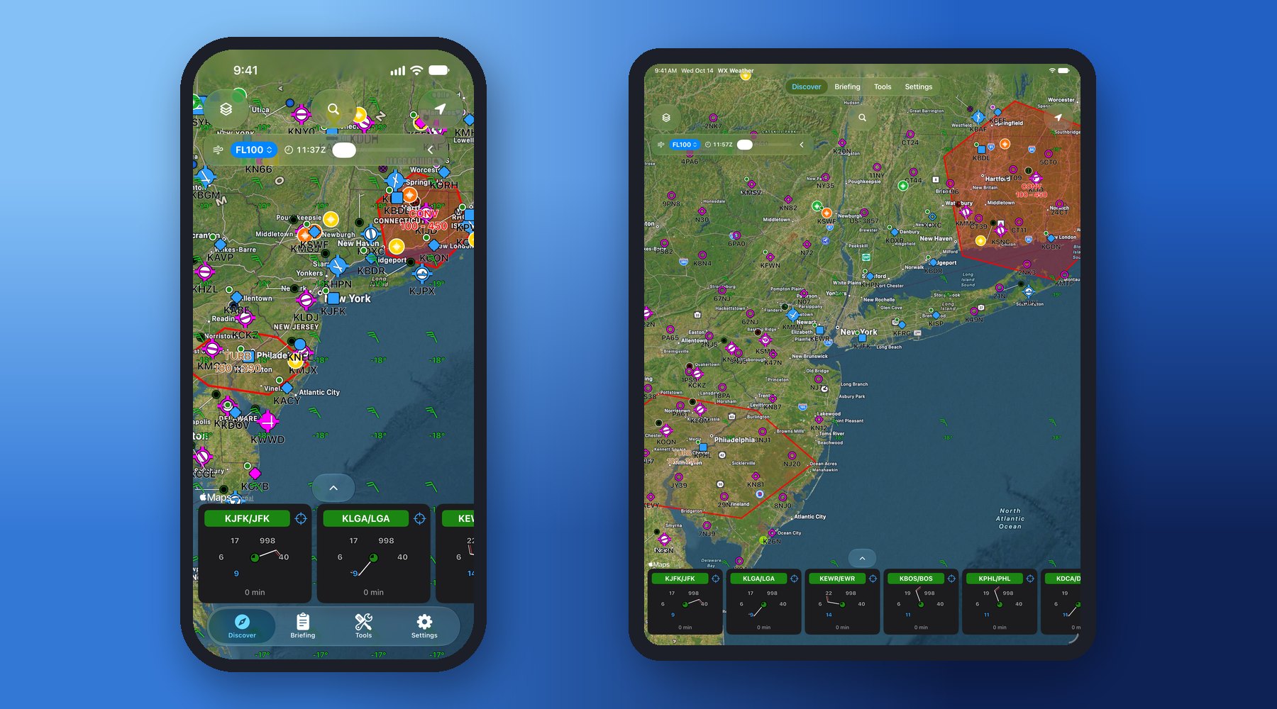
• Adaptive weather map: flight category, wind barbs and runway layout — zoom in for more METAR detail.
• SIGMET/AIRMET areas and pilot reports (PIREP): turbulence and icing reported by other aircraft, color-coded by severity.
• Winds & temperatures aloft layer: standard wind barbs at your flight level, with temperatures and a forecast time slider (Premium).
• Press and hold anywhere on the map to drop a pin: coordinates, position from the nearest airport, nearby airports, magnetic variation and sunrise/sunset.
Route briefing – an advisory go/no-go for the whole flight
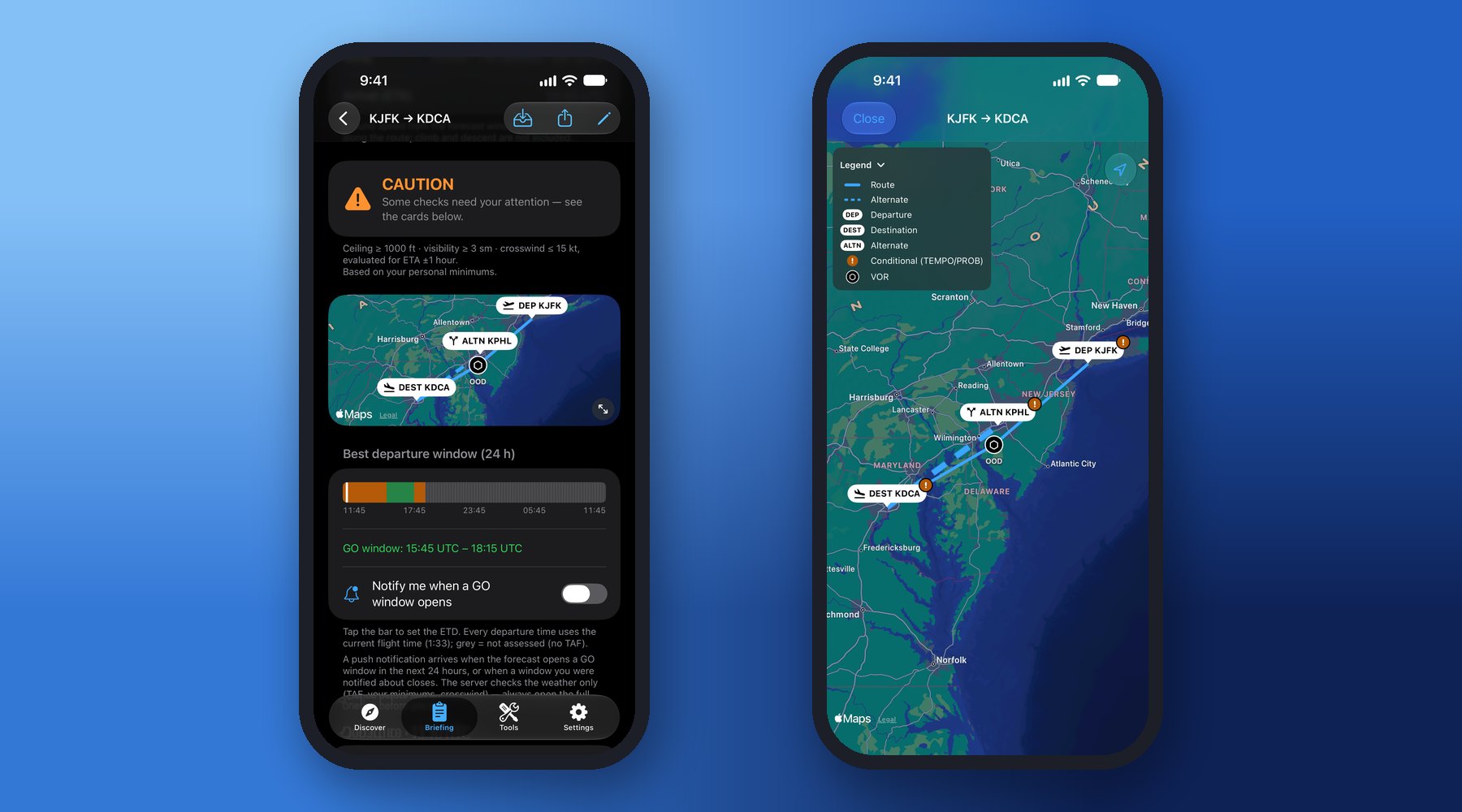
• Save your regular routes: departure, waypoints (navaids or any point on the map), destination and alternate.
• Advisory go/no-go for each airport at its own time — departure at ETD, destination and alternate at ETA — against your minimums, crosswind and runway-closure NOTAMs.
• En-route SIGMET/AIRMET and PIREPs along the route, with flight time corrected for winds aloft.
• Possible departure windows over the next 24 hours, with a push notification when a GO window opens.
• The verdicts are automated advisories based on forecasts and the limits you set — you, as pilot in command, make the go/no-go decision.
• Route map, alternate finder, saved offline briefings and PDF export — with a jump-to-section menu and a full-screen route map that brings the whole route back in one tap.
• One saved route, the route map and the current flight categories are free; the go/no-go briefing, the departure window, saving and exporting briefings are part of Premium.
Weather timeline and personal minimums
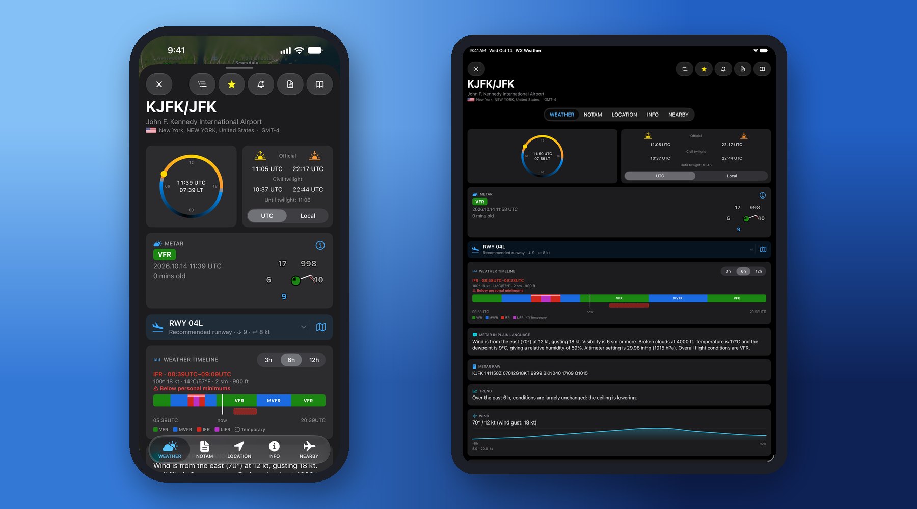
• METAR history and the TAF forecast on one time axis with a NOW marker — tap any segment to read the decoded wind, temperature, visibility and ceiling.
• Personal minimums: set your own ceiling, visibility and crosswind limits; periods below them are highlighted right on the timeline.
• TAF verification: see how the previous TAF actually verified against the observed METARs.
• Trend (2 h): the landing forecast at the end of the METAR — NOSIG, BECMG or TEMPO — on its own card.
NOTAM timeline – what is in force when you fly
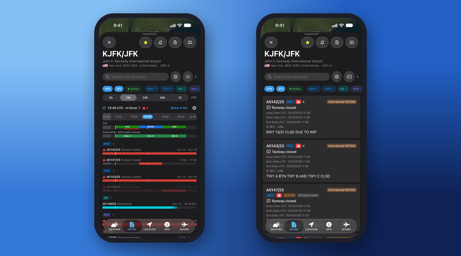
• Every NOTAM on one time axis, together with the TAF and the crosswind on the best open runway.
• Pick your departure time to see exactly what is in force — schedules (D) and estimated end times (EST) included.
• Critical NOTAMs highlighted; filter by category; runway closures, ILS, lighting and navaid outages at a glance.
Runways, crosswind and airport diagram
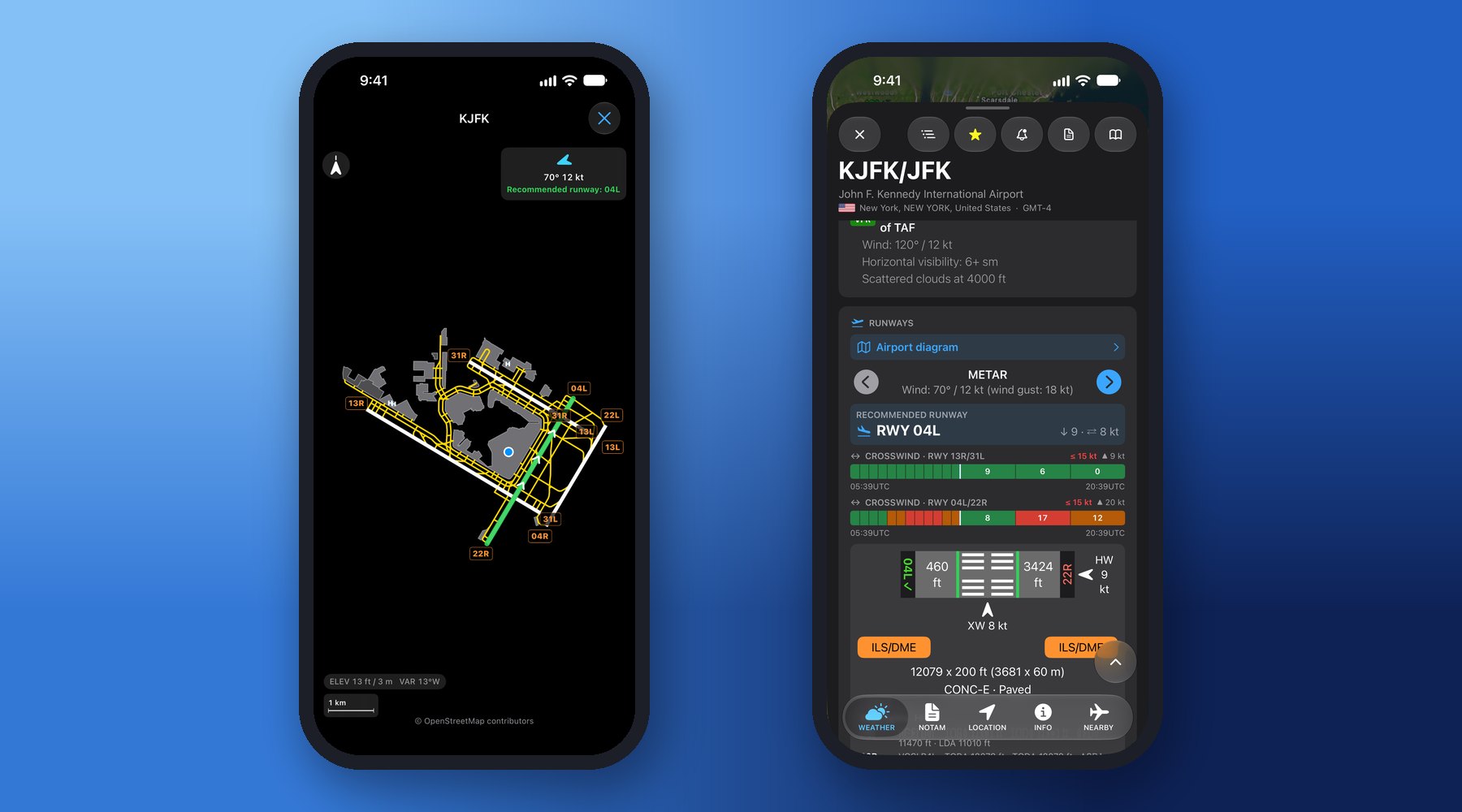
• Headwind and crosswind components for every runway, with the runway best suited to the wind.
• Per-runway crosswind timeline — a color-coded bar for recent and forecast crosswind, with your personal limit marked.
• Airport Diagram: runways, taxiways and aprons drawn from open map data.
Raw, decoded and in plain language
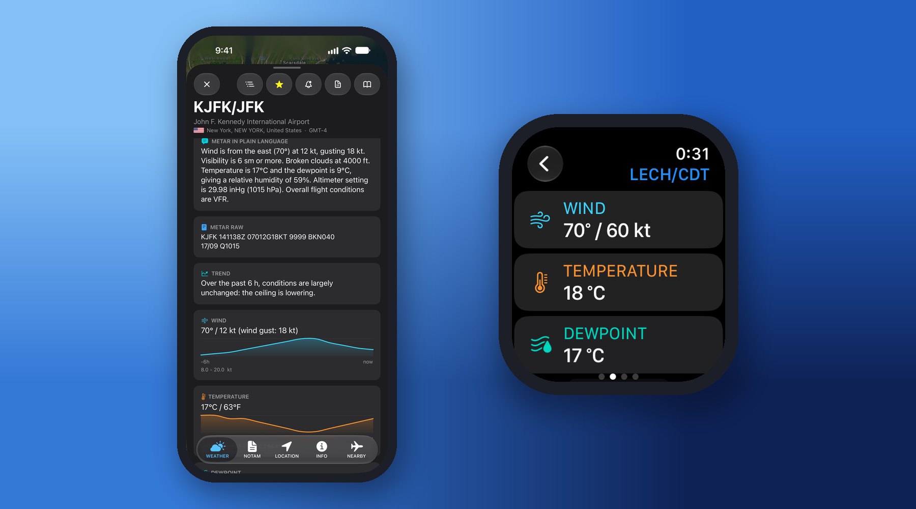
• METAR and TAF raw and fully decoded, with the observation age always visible.
• METAR, TAF and NOTAM in plain language — flowing summaries, no shorthand required.
• Shareable PDF and text reports for an airport, your favorites or a whole group (Premium).
Favorites, groups and Weather Alerts
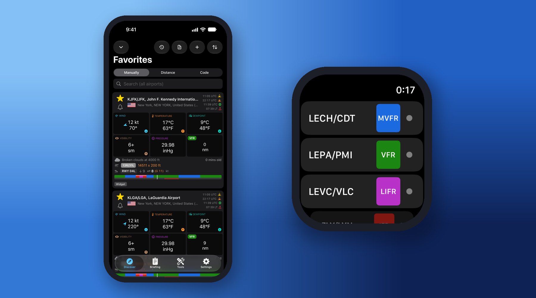
• Keep your airports in Favorites and Groups — the weather of every station side by side.
• Local flight window (Premium): on every favorite, a 24-hour bar shows when a one-hour local flight fits — GO, CAUTION or NO-GO every quarter hour from the TAF, your minimums and the crosswind, with night shaded. The airport details add runway-closure NOTAMs and explain any time you tap.
• Weather Alerts (Premium): a push notification the moment conditions change at the airports you monitor — flight category, personal minimums, crosswind, TAF go/no-go and NOTAM (runway closures, ILS, lighting or navaid outages).
• Favorites, Groups, Routes and Settings sync across your devices with iCloud.
iPhone, iPad, Apple Watch and widgets
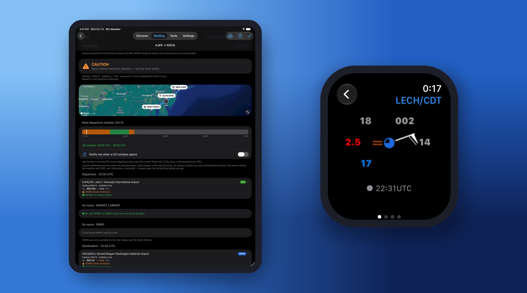
• iPad: the full app on the big screen — map, route briefing and airport details with room to spare.
• Apple Watch: your favorite airports with decoded reports, raw data and plain-language METAR & TAF; a watch face complication shows up to 4 favorites.
• Home Screen widgets: Weather Timeline, METAR, METAR & TAF, Weather Symbols and METAR in plain language.
Airport database – works offline
• 50,000+ airports, heliports and seaplane bases with runways, frequencies, navaids and elevation, stored on your device.
• ICAO/IATA codes, UTC and local time, sunrise/sunset and magnetic variation.
• Nearby airports, filterable by runway length and METAR/VFR availability — and an alternate finder for your arrival time (Premium).
Pilot tools
• Density altitude, crosswind, twilight (civil, nautical, astronomical) and day/night flight time calculators.
• Pilot stopwatch with lap times.
Free and Premium
| Free | Premium | |
|---|---|---|
| METAR, TAF, NOTAM, SIGMET, PIREP — raw, decoded and plain language | ✓ | ✓ |
| Weather map, timelines, crosswind, airport diagram, pilot tools | ✓ | ✓ |
| Offline airport database and nearby airports | ✓ | ✓ |
| Favorite airports | 1 | Unlimited |
| Groups | 1 group, 2 airports | Unlimited |
| Route briefing (advisory go/no-go, en-route hazards, departure windows, route map) | 1 route: route map and current flight categories | Unlimited, full briefing |
| Winds & temperatures aloft | — | ✓ |
| PDF & text report export | — | ✓ |
| Alternate finder for your arrival time | — | ✓ |
| Local flight window (24-hour GO/CAUTION/NO-GO) | — | ✓ |
| Weather Alerts push notifications | — | ✓ |
Premium is an auto-renewable subscription (monthly or yearly) with a 7-day free trial, and can be shared with Family Sharing. Cancel anytime in your Apple Account settings. Owners of the earlier one-time Pro purchase keep all Pro features.
Important: WX Aviation Weather is for situational awareness. It is not an official briefing source and must not be the sole basis of a flight decision. Go/no-go verdicts and departure windows are automated advisories — the pilot in command makes every decision. If METAR, TAF, NOTAM or SIGMET data is missing, it is unavailable at the source. Always obtain an official pre-flight briefing.